
Mobile app · UAV control
AniTech GCS · In active development
A ground control station in your hand.
AniTech GCS is a mobile ground control station for ArduPilot / Pixhawk drones. Its interface brings MAVLink telemetry, a flight HUD, maps and camera imagery together for operators on the move.
React Native
Expo app for Android / iOS
MAVLink
Vehicle connection and telemetry
03
HUD · Video · Map
GCS
Mobile monitoring and control
01 / The challenge
Flight information must stay clear on a small screen.
Operators need connection, position, battery and motion data in one workflow. Control commands need visible states and understandable safety conditions.
02 / System design
One data flow, several ways to see it.
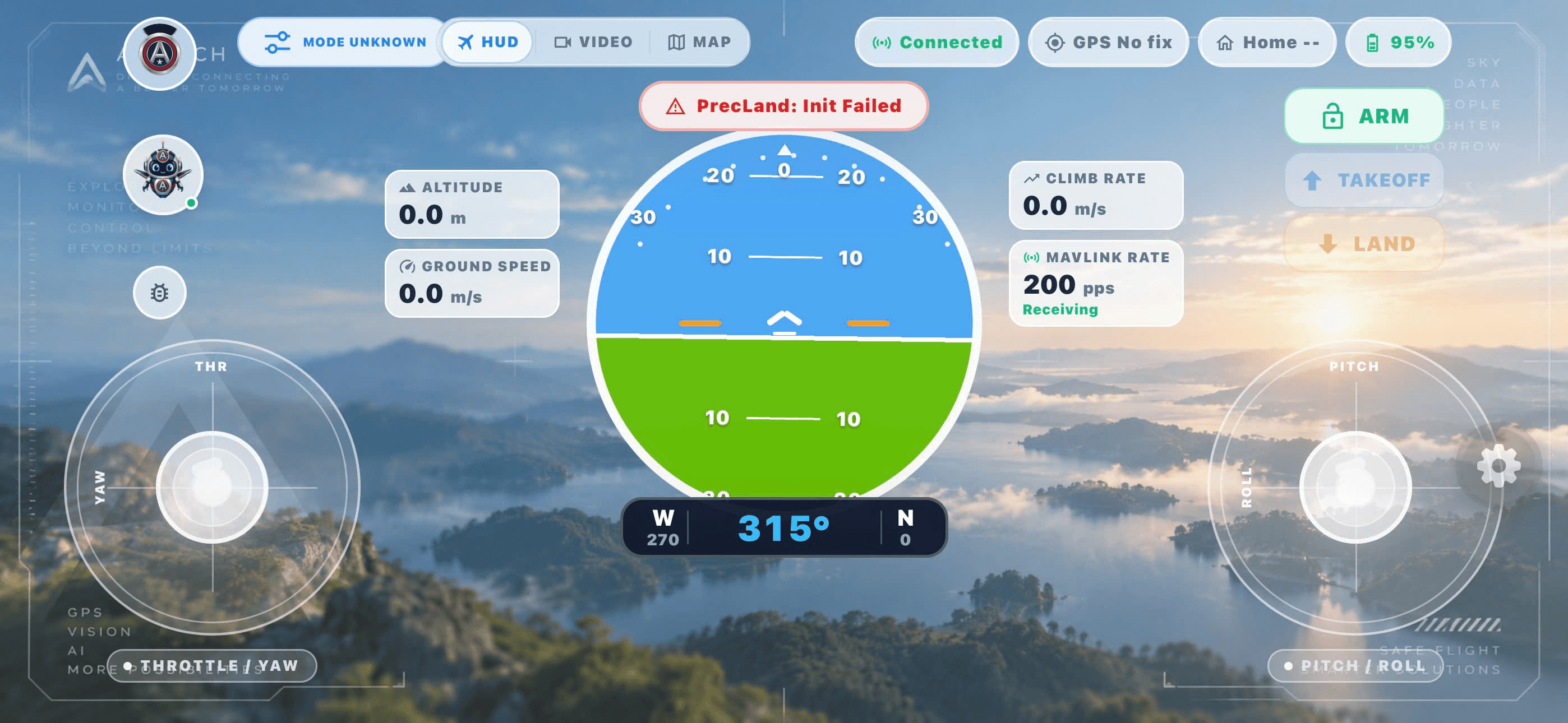
HUD
Shows an artificial horizon, heading, altitude, speed and vehicle status.
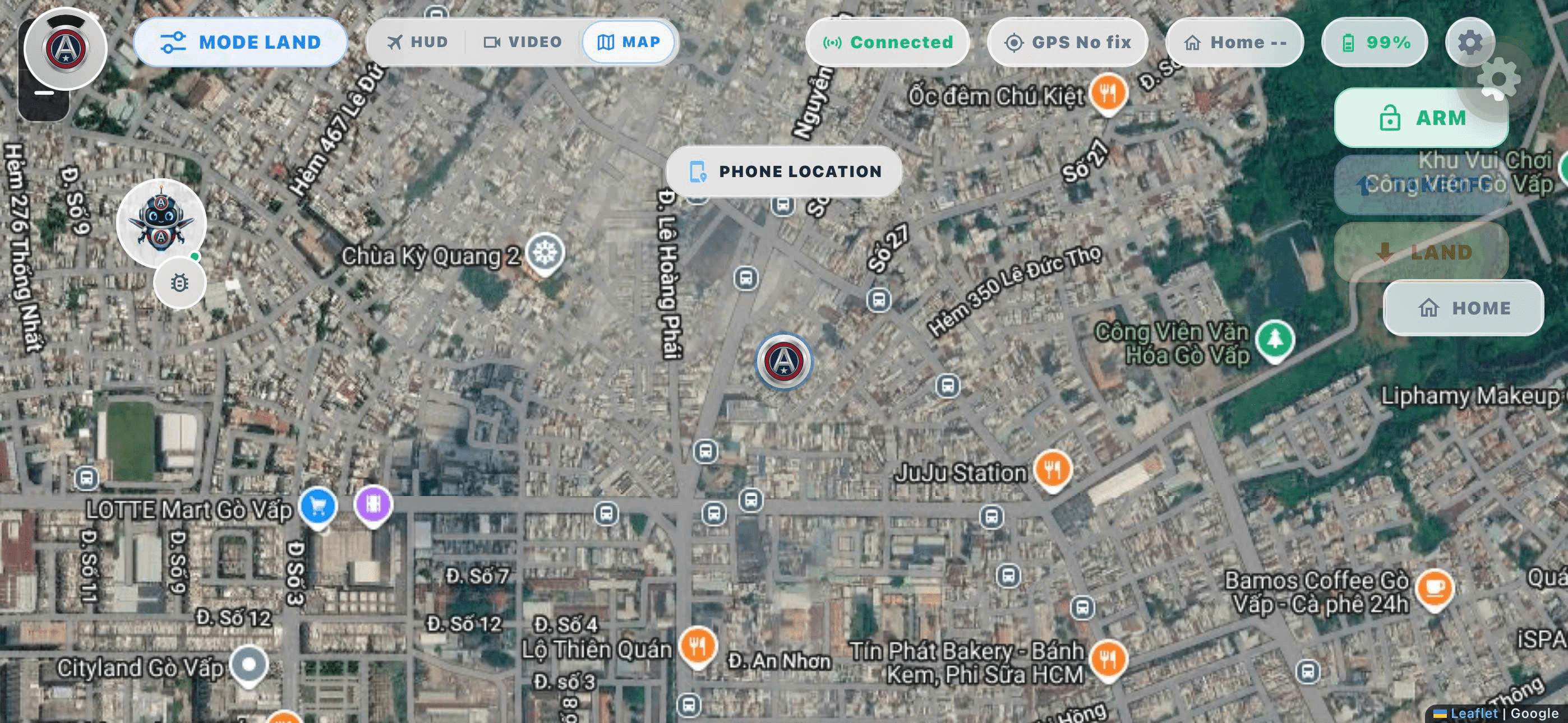
Map
Distinguishes phone and vehicle positions while displaying heading, Home and route context.
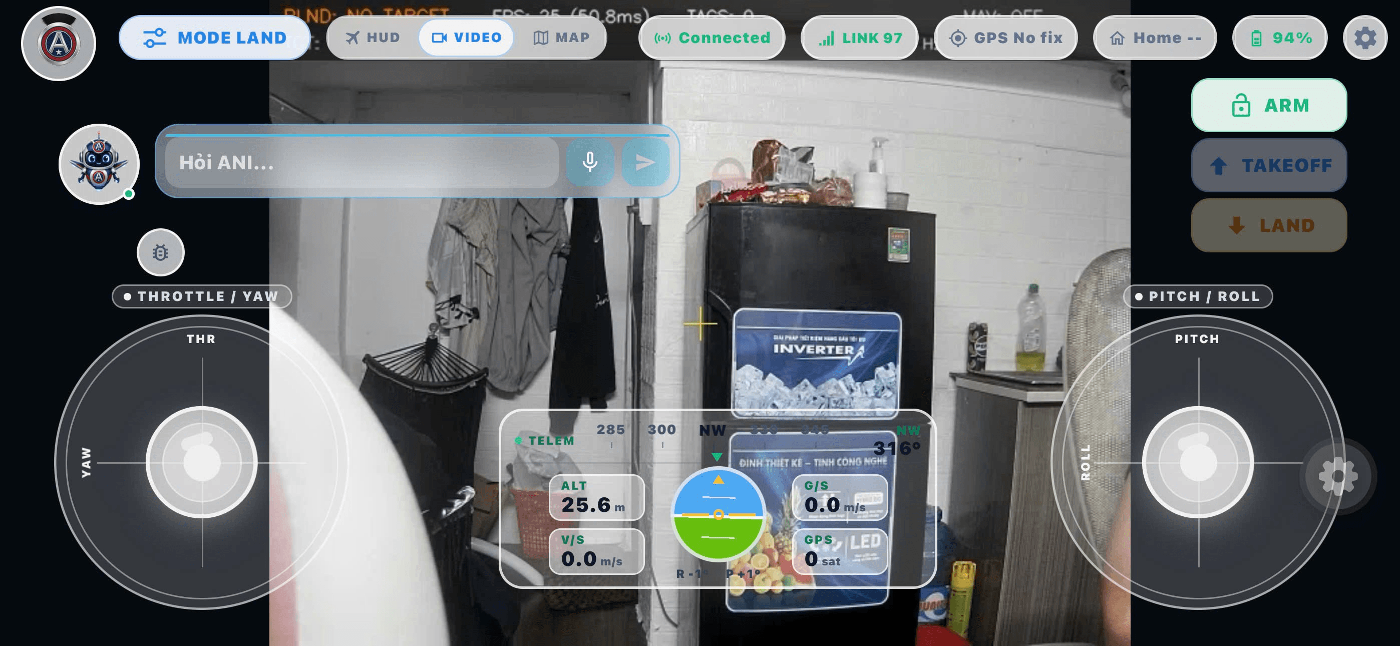
Video
Switches to camera imagery when a stream is available while keeping flight data in view.
03 / Application interface
From flight data to maps and camera imagery.
Screenshots supplied by the project owner show the app interface at the time of capture. They are not evidence of a completed flight test.
Project status
Open source and still evolving.
The public repository contains the app, flight screens, maps, video views and connection layers. Mission planning and hardware integration should be evaluated against the current version and deployment environment; this page does not claim a verified flight test.